Burrows Cottage
Introduction
The photograph on this page of Burrows Cottage by Alan Hughes as part of the Geograph project.
The Geograph project started in 2005 with the aim of publishing, organising and preserving representative images for every square kilometre of Great Britain, Ireland and the Isle of Man.

There are currently over 7.5m images from over 14,400 individuals and you can help contribute to the project by visiting https://www.geograph.org.uk
Burrows Cottage
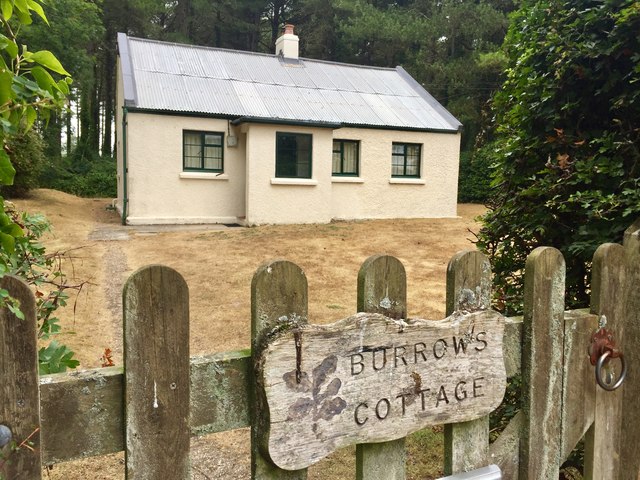
Image: © Alan Hughes Taken: 23 Jul 2018
Burrows Cottage is a simple, single-storey former forester’s cottage now used as a bunk house by the National Trust. Located in a secluded spot alongside a pine wood below Cwm Ivy Tor.
Images are licensed for reuse under creativecommons.org/licenses/by-sa/2.0
Image Location
Latitude
51.623424
Longitude
-4.258738