The Douping Stane
Introduction
The photograph on this page of The Douping Stane by Bill Harrison as part of the Geograph project.
The Geograph project started in 2005 with the aim of publishing, organising and preserving representative images for every square kilometre of Great Britain, Ireland and the Isle of Man.

There are currently over 7.5m images from over 14,400 individuals and you can help contribute to the project by visiting https://www.geograph.org.uk
The Douping Stane
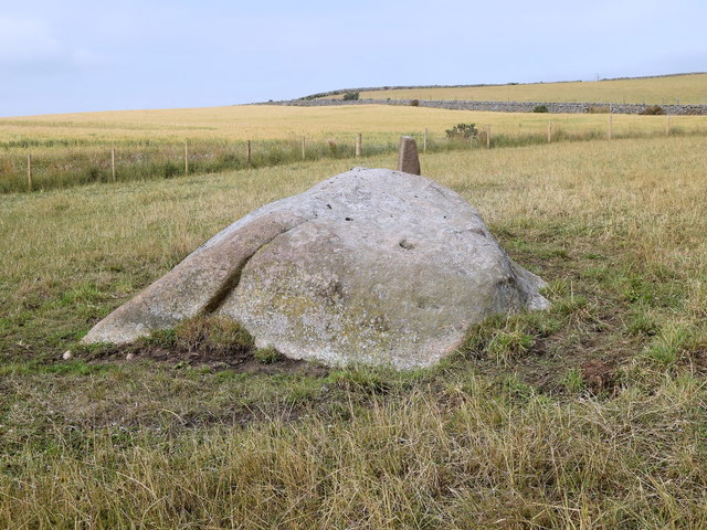
Image: © Bill Harrison Taken: 21 Jul 2018
This huge granite boulder has marked the north-west extremity of the Freedom Lands of Aberdeen for several hundred years, although it also appears to have Neolithic 'cup' marks upon it. 'Douping' is old Scots for dropping: new Burgesses of the Guild of Aberdeen (see: http://www.aberdeenburgesses.com/ ) would be ridden out to this stane and ceremonially 'douped' (dropped) onto the stone as part of their initiation. See Canmore record 19346 for more: https://canmore.org.uk/site/19346/aberdeen-wynford-boundary-marker-31 . The modern Aberdeen march stone number 31 can be seen just behind the stane.
Images are licensed for reuse under creativecommons.org/licenses/by-sa/2.0
Image Location
Latitude
57.17488
Longitude
-2.266752