Hemel Hempstead: High Street Green Triangulation Pillar
Introduction
The photograph on this page of Hemel Hempstead: High Street Green Triangulation Pillar by Nigel Cox as part of the Geograph project.
The Geograph project started in 2005 with the aim of publishing, organising and preserving representative images for every square kilometre of Great Britain, Ireland and the Isle of Man.

There are currently over 7.5m images from over 14,400 individuals and you can help contribute to the project by visiting https://www.geograph.org.uk
Hemel Hempstead: High Street Green Triangulation Pillar
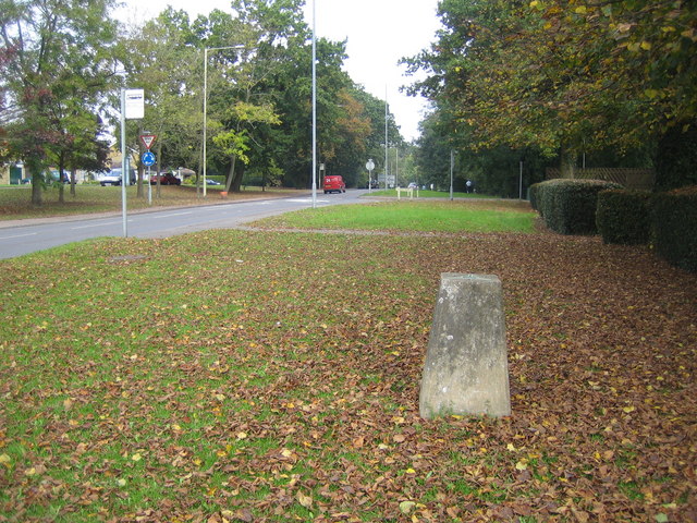
Image: © Nigel Cox Taken: 14 Oct 2007
Now rather incongruously sited in the grass verge on the east side of High Street Green and surrounded by houses and trees, this survey triangulation pillar, which was originally surveyed in 1948, served its purpose before and during the development of Hemel Hempstead after the Second World War. Its published co-ordinates are Easting 507237.625, Northing 208316.031, but these have not been realised through the current ETRS89 (European Terrestrial Reference System 1989) and OSTN02 transformation parameters, so the OS would not consider them now to be the true co-ordinates. The height of the reference mark on the flush bracket on the side of the pillar is 148.556 metres above sea level.
Images are licensed for reuse under creativecommons.org/licenses/by-sa/2.0
Image Location
Latitude
51.763131
Longitude
-0.448057