Former ford, Knock Shield
Introduction
The photograph on this page of Former ford, Knock Shield by Andrew Smith as part of the Geograph project.
The Geograph project started in 2005 with the aim of publishing, organising and preserving representative images for every square kilometre of Great Britain, Ireland and the Isle of Man.

There are currently over 7.5m images from over 14,400 individuals and you can help contribute to the project by visiting https://www.geograph.org.uk
Former ford, Knock Shield
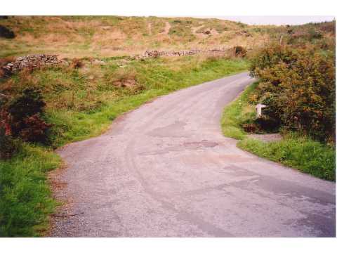
Image: © Andrew Smith Taken: Unknown
Formerly the site of a ford. Nowadays a culvert takes the stream under the road. However, the provision of a footbridge suggests that the water may still inundate the road after heavy rainfall.
Images are licensed for reuse under creativecommons.org/licenses/by-sa/2.0
Image Location


Leaflet Map data © OpenStreetMap
Latitude
54.849934
Longitude
-2.255385