Houses, Northland Road, Donaghadee (July 2018)
Introduction
The photograph on this page of Houses, Northland Road, Donaghadee (July 2018) by Albert Bridge as part of the Geograph project.
The Geograph project started in 2005 with the aim of publishing, organising and preserving representative images for every square kilometre of Great Britain, Ireland and the Isle of Man.

There are currently over 7.5m images from over 14,400 individuals and you can help contribute to the project by visiting https://www.geograph.org.uk
Houses, Northland Road, Donaghadee (July 2018)
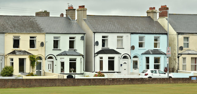
Image: © Albert Bridge Taken: 20 Jul 2018
Brightly-painted houses overlooking the cricket club Image The PRONI historic maps suggest that they were built some time around the turn of the last century. The maps also show that other houses (out of picture to the right) were built on the site of the former Donaghadee UDC allotments.
Images are licensed for reuse under creativecommons.org/licenses/by-sa/2.0
Image Location
Latitude
54.639487
Longitude
-5.537859