Blaxland Farmhouse
Introduction
The photograph on this page of Blaxland Farmhouse by Robin Webster as part of the Geograph project.
The Geograph project started in 2005 with the aim of publishing, organising and preserving representative images for every square kilometre of Great Britain, Ireland and the Isle of Man.

There are currently over 7.5m images from over 14,400 individuals and you can help contribute to the project by visiting https://www.geograph.org.uk
Blaxland Farmhouse
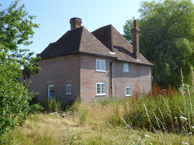
Image: © Robin Webster Taken: 8 Jul 2018
An early 15th century grade II listed building, described as timber framed, refronted with brick on the front elevation. As far as can be seen externally it is now brick all round, presumably the result of recent work which appears unfinished. The house is empty.
Images are licensed for reuse under creativecommons.org/licenses/by-sa/2.0
Image Location
Latitude
51.326866
Longitude
1.102244