Weighton Lock
Introduction
The photograph on this page of Weighton Lock by Paul Glazzard as part of the Geograph project.
The Geograph project started in 2005 with the aim of publishing, organising and preserving representative images for every square kilometre of Great Britain, Ireland and the Isle of Man.

There are currently over 7.5m images from over 14,400 individuals and you can help contribute to the project by visiting https://www.geograph.org.uk
Weighton Lock
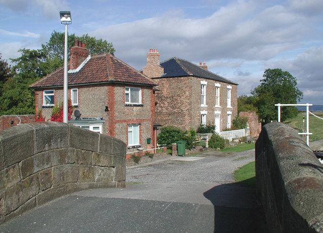
Image: © Paul Glazzard Taken: 12 Oct 2007
Looking north-northwest from the bridge over the lock towards the lock keeper's cottage (appropriately named 'Weighton Lock') and Humber Lock Farm beyond. The 9½ mile long Market Weighton Canal from the town of Market Weighton to the River Humber was ordered by Act of Parliament in 1772 and opened in 1782. Much of the canal had been neglected by 1900 and the right of navigation through the lock on the Humber was lost in 1971. The lock was refurbished in 1994 by the National Rivers Authority and reopened on 26 May 1995.
Images are licensed for reuse under creativecommons.org/licenses/by-sa/2.0
Image Location
Latitude
53.720031
Longitude
-0.676253