Snaith Town Lock-up
Introduction
The photograph on this page of Snaith Town Lock-up by Paul Glazzard as part of the Geograph project.
The Geograph project started in 2005 with the aim of publishing, organising and preserving representative images for every square kilometre of Great Britain, Ireland and the Isle of Man.

There are currently over 7.5m images from over 14,400 individuals and you can help contribute to the project by visiting https://www.geograph.org.uk
Snaith Town Lock-up
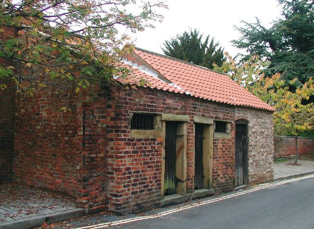
Image: © Paul Glazzard Taken: 10 Oct 2007
Cells on Buttermarket just east of the Priory Church of St Laurence at Snaith. Conflicting information boards on the street date them to either the 18th or 19th century and there are many theories about their purpose, but it is thought likely they were a short-term lock-up for people getting drunk and disorderly on market days. The cells were once part of a row of similar sized buildings running for some distance along the street.
Images are licensed for reuse under creativecommons.org/licenses/by-sa/2.0
Image Location


Leaflet Map data © OpenStreetMap
Latitude
53.692137
Longitude
-1.030148