Glenariff, bridge piers
Introduction
The photograph on this page of Glenariff, bridge piers by Mike Faherty as part of the Geograph project.
The Geograph project started in 2005 with the aim of publishing, organising and preserving representative images for every square kilometre of Great Britain, Ireland and the Isle of Man.

There are currently over 7.5m images from over 14,400 individuals and you can help contribute to the project by visiting https://www.geograph.org.uk
Glenariff, bridge piers
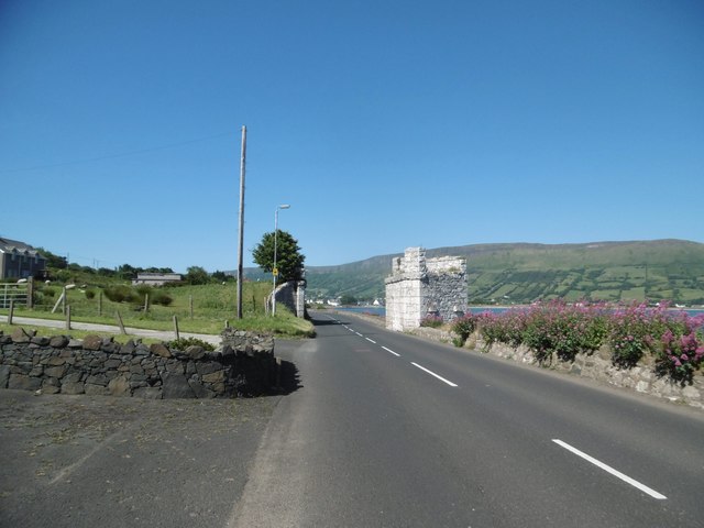
Image: © Mike Faherty Taken: 24 Jun 2018
Once carrying the Glenariff Railway across Garron Road (A2), from iron ore mines at Cargan to a pier, traces of which survive in the sea.
Images are licensed for reuse under creativecommons.org/licenses/by-sa/2.0
Image Location
Latitude
55.054598
Longitude
-6.035653