Garron, cliff
Introduction
The photograph on this page of Garron, cliff by Mike Faherty as part of the Geograph project.
The Geograph project started in 2005 with the aim of publishing, organising and preserving representative images for every square kilometre of Great Britain, Ireland and the Isle of Man.

There are currently over 7.5m images from over 14,400 individuals and you can help contribute to the project by visiting https://www.geograph.org.uk
Garron, cliff
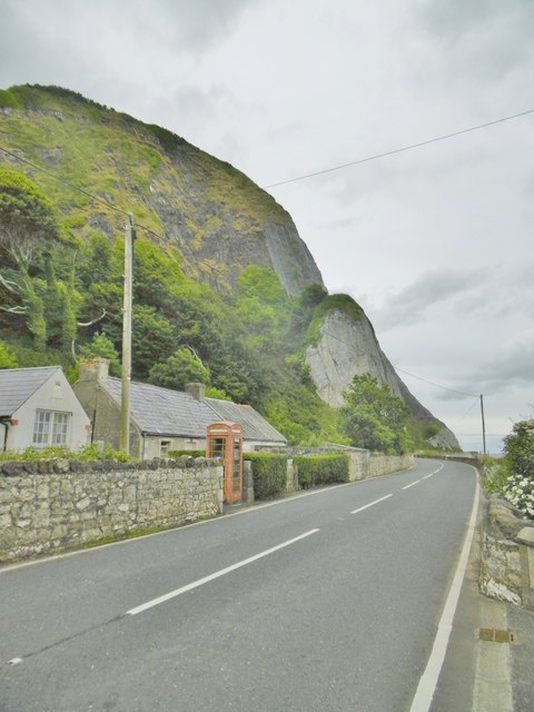
Image: © Mike Faherty Taken: 20 Jun 2018
On A2 (Causeway Coastal Route). A dramatic cliff, clearly showing basalt strata at the top, and Cretaceous limestone lower down. Note, the cliff is netted!
Images are licensed for reuse under creativecommons.org/licenses/by-sa/2.0
Image Location
Latitude
55.045788
Longitude
-5.964265