Hemsley House
Introduction
The photograph on this page of Hemsley House by Gerald England as part of the Geograph project.
The Geograph project started in 2005 with the aim of publishing, organising and preserving representative images for every square kilometre of Great Britain, Ireland and the Isle of Man.

There are currently over 7.5m images from over 14,400 individuals and you can help contribute to the project by visiting https://www.geograph.org.uk
Hemsley House
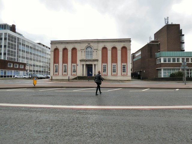
Image: © Gerald England Taken: 5 Mar 2018
The Masonic Hall at 41-42 The Crescent was built in the 1920s replacing two original Georgian Houses. http://manchesterhistory.net/manchester/outside/SALFORD/hemsleyhouse.html Faraday House on the left belongs to the University of Salford but was originally occupied in the 1970s by the Amalgamated Union of Engineering Workers (AUEW). http://manchesterhistory.net/manchester/outside/SALFORD/faradayhouse.html Crescent House on the left was built in the 1960s and is also part of the University of Salford.
Images are licensed for reuse under creativecommons.org/licenses/by-sa/2.0
Image Location
Latitude
53.483362
Longitude
-2.270303