Taylor Street, Dalquhurn
Introduction
The photograph on this page of Taylor Street, Dalquhurn by Lairich Rig as part of the Geograph project.
The Geograph project started in 2005 with the aim of publishing, organising and preserving representative images for every square kilometre of Great Britain, Ireland and the Isle of Man.

There are currently over 7.5m images from over 14,400 individuals and you can help contribute to the project by visiting https://www.geograph.org.uk
Taylor Street, Dalquhurn
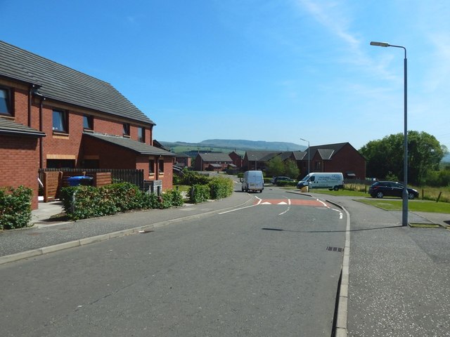
Image: © Lairich Rig Taken: 27 Jun 2018
The view is from near the southwestern end of the street. The houses shown here were built c.2011. The picture was taken in connection with a Geograph article (linked from the first end-note) describing my research into the former location of the farm buildings of Pillanflatt. The farm seems to have been in existence in 1841, but its buildings had completely disappeared by the time the earliest OS map of the area was surveyed in 1860. Pillanflatt's eastern building, which was probably the farmhouse, stood near the white van that is facing away from the viewer (the van's fortuitous position happens to make it a good reference point). The two western buildings stood at about the spot from which the picture was taken (shown in Image). The eastern building and two western buildings being referred to here are the ones shown on an 1841 plan: to view the relevant part of that plan, see https://www.geograph.org.uk/article/The-location-of-Pillanflatt-Farm#comparisons in the article already mentioned. The old line of a track called the Howgate, which appears originally to have provided access to Pillanflatt Farm, passed through the houses on the right (the southern side of the street). See also Image, a view in the opposite direction. The old course of the Howgate, in relation to present-day features, is best seen in the annotated satellite view that is linked from the first end-note. In that view, the old course of the track is marked as a yellow line. The Howgate now follows a slightly different route, a little further to the south, which marked as a green line on the annotated satellite view.
Images are licensed for reuse under creativecommons.org/licenses/by-sa/2.0
Image Location
Latitude
55.963706
Longitude
-4.58103