Looking across the Royal Military Canal
Introduction
The photograph on this page of Looking across the Royal Military Canal by Marathon as part of the Geograph project.
The Geograph project started in 2005 with the aim of publishing, organising and preserving representative images for every square kilometre of Great Britain, Ireland and the Isle of Man.

There are currently over 7.5m images from over 14,400 individuals and you can help contribute to the project by visiting https://www.geograph.org.uk
Looking across the Royal Military Canal
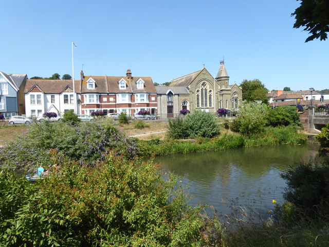
Image: © Marathon Taken: 8 Jul 2018
The Royal Military Canal was built between 1804 and 1809 as a response to the threat of a Napoleonic invasion. At its peak there were 1,500 men working on the canal. The canal was dug entirely by hand, using picks and shovels and the soil was carried away in wheelbarrows. It runs for 28 miles between Seabrook near Folkestone and Cliff End near Hastings, and follows the old cliff line bordering Romney Marsh. Artillery batteries were generally located every 500 yards where the canal was staggered to create a salient, allowing the guns to cover the next stretch of water. A military road was built on the inland side of the canal, and crossings consisted of moveable wooden bridges. The Military Road still follows the inland side of the Canal. Although it was never called into action, the canal was fortified with concrete pillboxes during the early stages of the Second World War, when a German invasion was looking likely. Only three of these now remain. Its other original purpose was to act as a major drainage system for the winter, and a reservoir for the summer and so greatly improve conditions on Romney Marsh. It still does this today as the Environment Agency uses the waterway to manage water levels on Romney Marsh and Walland Marsh. In Hythe it provides an amenity as seen here on the hottest day of the year. Hythe Methodist Church in Rampart Road can be seen on the opposite bank.
Images are licensed for reuse under creativecommons.org/licenses/by-sa/2.0
Image Location
Latitude
51.070506
Longitude
1.082204