Wishford House
Introduction
The photograph on this page of Wishford House by Derek Harper as part of the Geograph project.
The Geograph project started in 2005 with the aim of publishing, organising and preserving representative images for every square kilometre of Great Britain, Ireland and the Isle of Man.

There are currently over 7.5m images from over 14,400 individuals and you can help contribute to the project by visiting https://www.geograph.org.uk
Wishford House
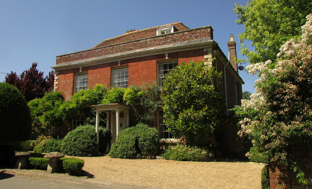
Image: © Derek Harper Taken: 30 Jun 2018
The house is listed and described at https://www.historicengland.org.uk/listing/the-list/list-entry/1182762 : "C18, altered and refronted c1800 ... wooden Tuscan porch". The Monarch's Way runs past.
Images are licensed for reuse under creativecommons.org/licenses/by-sa/2.0
Image Location
Latitude
51.118914
Longitude
-1.888366