Wall, Great Wishford
Introduction
The photograph on this page of Wall, Great Wishford by Derek Harper as part of the Geograph project.
The Geograph project started in 2005 with the aim of publishing, organising and preserving representative images for every square kilometre of Great Britain, Ireland and the Isle of Man.

There are currently over 7.5m images from over 14,400 individuals and you can help contribute to the project by visiting https://www.geograph.org.uk
Wall, Great Wishford
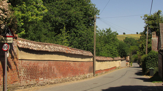
Image: © Derek Harper Taken: 30 Jun 2018
The Monarch's Way follows West Street past a fine stretch of wall adjoining the grounds of Wishford House. This ought to be the "length of good cob wall with flint plinth and thatched capping, with some brick patching" referred to at https://www.historicengland.org.uk/listing/the-list/list-entry/1182762 , but clearly this wall is not thatched. The listing dates originally from 1960 but was amended in 1986.
Images are licensed for reuse under creativecommons.org/licenses/by-sa/2.0
Image Location
Latitude
51.118824
Longitude
-1.887937