Horse Shoe Bridge
Introduction
The photograph on this page of Horse Shoe Bridge by Derek Harper as part of the Geograph project.
The Geograph project started in 2005 with the aim of publishing, organising and preserving representative images for every square kilometre of Great Britain, Ireland and the Isle of Man.

There are currently over 7.5m images from over 14,400 individuals and you can help contribute to the project by visiting https://www.geograph.org.uk
Horse Shoe Bridge
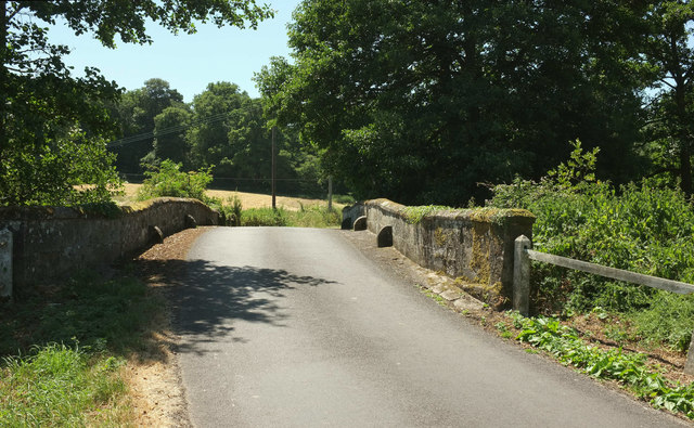
Image: © Derek Harper Taken: 30 Jun 2018
Confusingly, this bridge across the River Nadder is mapped in different squares at different scales; the 1:50000 has it in Image, but it seems to be definitely in Image It can't be that the river has shifted course, at least not since the "late C18" when the bridge was built. Also confusing is the fact that three parishes meet here and there are two listed building descriptions, for Dinton parish (on the right here) https://www.historicengland.org.uk/listing/the-list/list-entry/1146153 and for Compton Chamberlayne (across the river) https://www.historicengland.org.uk/listing/the-list/list-entry/1318754 . The descriptions are, however, identical, including the following, visible here: "plain parapet with pitched coping. Slightly angled abutment walls with square end piers". The third parish, to the left of the lane on this side of the river, is Barford St Martin. The wood in the background is Horse Shoe Copse.
Images are licensed for reuse under creativecommons.org/licenses/by-sa/2.0
Image Location
Latitude
51.078313
Longitude
-1.950844