
St Mary's Works on St Mary's Plain
Introduction
The photograph on this page of St Mary's Works on St Mary's Plain by Evelyn Simak as part of the Geograph project.
The Geograph project started in 2005 with the aim of publishing, organising and preserving representative images for every square kilometre of Great Britain, Ireland and the Isle of Man.

There are currently over 7.5m images from over 14,400 individuals and you can help contribute to the project by visiting https://www.geograph.org.uk
St Mary's Works on St Mary's Plain
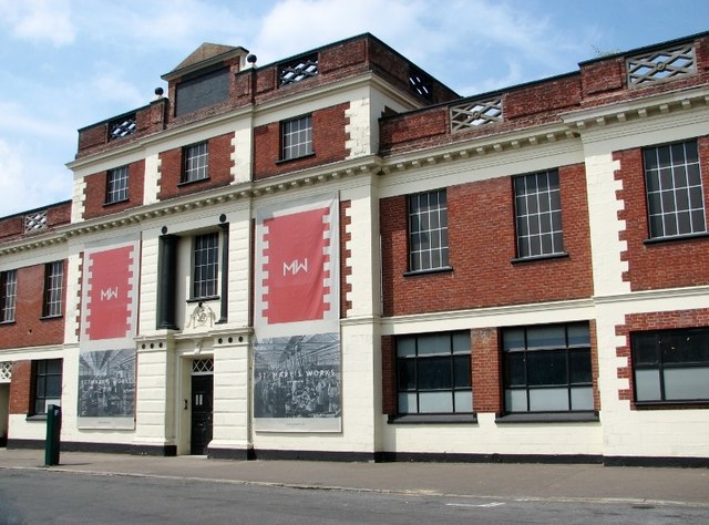
Image: © Evelyn Simak Taken: 6 Jul 2018
St Mary's Works is named after St Mary's church - commonly referred to as St Mary Coslany > https://www.geograph.org.uk/photo/1958579 - which adjoins it. It housed the Sexton, Son & Everard shoe factory > http://www.geograph.org.uk/photo/5834592 which operated from 1876 until 1976. Current plans are to convert it into 151 flats, office space, a hotel with a restaurant, galleries and shops. The building is currently being used as a space for community arts and events.
Images are licensed for reuse under creativecommons.org/licenses/by-sa/2.0
Image Location

Latitude
52.633988
Longitude
1.290632