"The Gusset", Omagh
Introduction
The photograph on this page of "The Gusset", Omagh by Kenneth Allen as part of the Geograph project.
The Geograph project started in 2005 with the aim of publishing, organising and preserving representative images for every square kilometre of Great Britain, Ireland and the Isle of Man.

There are currently over 7.5m images from over 14,400 individuals and you can help contribute to the project by visiting https://www.geograph.org.uk
"The Gusset", Omagh
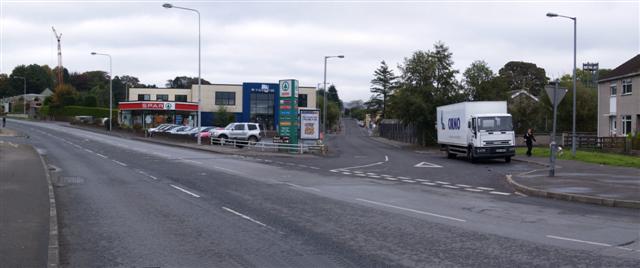
Image: © Kenneth Allen Taken: 13 Oct 2007
The locals refer to the "V" shaped wedge of land formed at the intersection of the Gortin Road, Mountjoy Road and the Killybrack Road as "The Gusset", something which I only found out recently. The Lisnamallard Burn passes across the road in a culvert at this spot, coming alongside the Circular Road, and then running down the hidden glen between the Grange and the MOD property, to join the river Strule north of the town
Images are licensed for reuse under creativecommons.org/licenses/by-sa/2.0
Image Location


Leaflet Map data © OpenStreetMap
Latitude
54.6068
Longitude
-7.299729