East end of Pisgah
Introduction
The photograph on this page of East end of Pisgah by Nigel Brown as part of the Geograph project.
The Geograph project started in 2005 with the aim of publishing, organising and preserving representative images for every square kilometre of Great Britain, Ireland and the Isle of Man.

There are currently over 7.5m images from over 14,400 individuals and you can help contribute to the project by visiting https://www.geograph.org.uk
East end of Pisgah
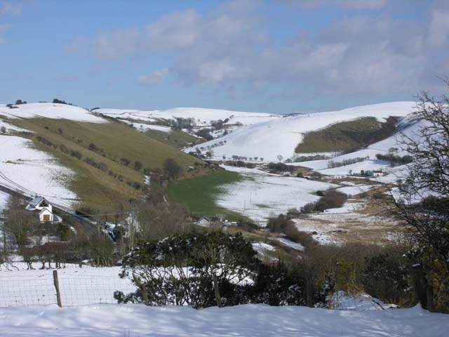
Image: © Nigel Brown Taken: 4 Mar 2006
The east end of this well spaced community lies in a dip, actually a col between the Rheidol and Gledryd valleys; the latter can be seen ahead. An ancient road to the east, now a bridleway, climbs along the valley side to the right, another old route proceeds up the valley, but today the main road, seen bottom left, sweeps left to contour high above the Rheidol valley.
Images are licensed for reuse under creativecommons.org/licenses/by-sa/2.0
Image Location
Latitude
52.381005
Longitude
-3.941632