Redhill from Reigate Hill
Introduction
The photograph on this page of Redhill from Reigate Hill by Ian Capper as part of the Geograph project.
The Geograph project started in 2005 with the aim of publishing, organising and preserving representative images for every square kilometre of Great Britain, Ireland and the Isle of Man.

There are currently over 7.5m images from over 14,400 individuals and you can help contribute to the project by visiting https://www.geograph.org.uk
Redhill from Reigate Hill
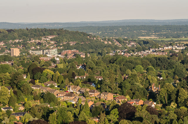
Image: © Ian Capper Taken: 29 Jun 2018
Looking towards Redhill from Reigate Hill. Prominent features are the Dome on the left and the Redhill town centre office buildings on the left of RedCentral and Kingsgate to its right. Behind them is Redstone Hill and on the right is housing on Red Hill, which gave the town its name. In front of the office buildings is Wray Common Windmill and across the foreground are houses in the Raglan Road area of Reigate. In the far distance is the Weald near East Grinstead with the High Weald beyond.
Images are licensed for reuse under creativecommons.org/licenses/by-sa/2.0
Image Location
Latitude
51.235586
Longitude
-0.169923