Castlemilk House Stables
Introduction
The photograph on this page of Castlemilk House Stables by Richard Sutcliffe as part of the Geograph project.
The Geograph project started in 2005 with the aim of publishing, organising and preserving representative images for every square kilometre of Great Britain, Ireland and the Isle of Man.

There are currently over 7.5m images from over 14,400 individuals and you can help contribute to the project by visiting https://www.geograph.org.uk
Castlemilk House Stables
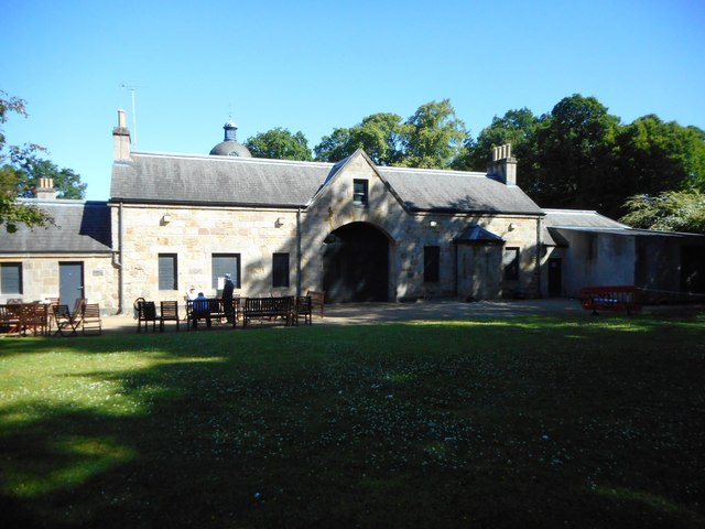
Image: © Richard Sutcliffe Taken: 30 Jun 2018
Seen from the south. This Category B listed building [http://portal.historicenvironment.scot/designation/LB33720] dating from the 1790s is now a centre for the local community, restored and run by the Cassiltoun Trust [http://www.cassiltountrust.org.uk/index.html]. It contains the local Housing Association offices, training suites, childcare facilities and space for community events.
Images are licensed for reuse under creativecommons.org/licenses/by-sa/2.0
Image Location
Latitude
55.807594
Longitude
-4.221491