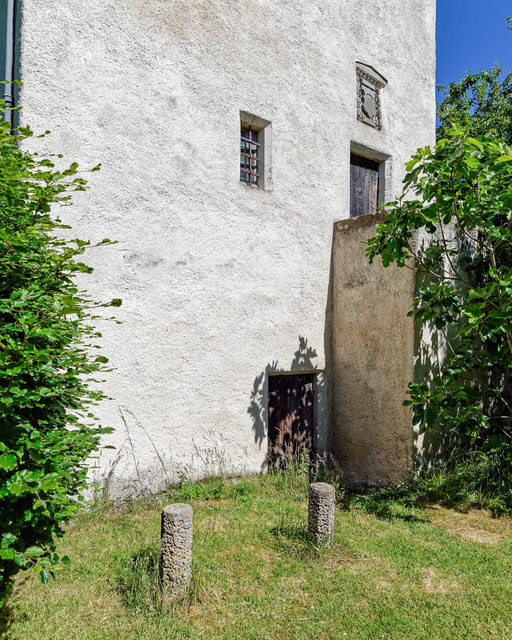
Coxton Tower Lhanbryde
Introduction
The photograph on this page of Coxton Tower Lhanbryde by valenta as part of the Geograph project.
The Geograph project started in 2005 with the aim of publishing, organising and preserving representative images for every square kilometre of Great Britain, Ireland and the Isle of Man.
There are currently over 7.5m images from over 14,400 individuals and you can help contribute to the project by visiting https://www.geograph.org.uk

Image: © valenta Taken: 24 Jun 2018
Ground floor doorway into the tower. This was used as a storage area, the doorway may have been a later addition to the tower. To the right of the doorway is the forestair to the main entrance door on the first floor. Above the doorway is an armorial panel, closer view here Image] The two concrete posts in the foreground were erected during the second world war when Canadian troops were stationed here. The posts were to stop the army lorry backing into the tower. The tower is said to date from 1644, although thought to be much older. https://www.britishlistedbuildings.co.uk/200349461-coxton-tower-fochabers-lhanbryde-ward#.Wzi7x8InZaQ Although the tower is in private ownership and not generally open to the public, an appointment to visit the tower may be arranged by contacting the owner.

