Stove House, Ditherington Flax Mill
Introduction
The photograph on this page of Stove House, Ditherington Flax Mill by Richard Law as part of the Geograph project.
The Geograph project started in 2005 with the aim of publishing, organising and preserving representative images for every square kilometre of Great Britain, Ireland and the Isle of Man.

There are currently over 7.5m images from over 14,400 individuals and you can help contribute to the project by visiting https://www.geograph.org.uk
Stove House, Ditherington Flax Mill
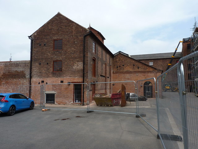
Image: © Richard Law Taken: 31 May 2018
The three-storey Stove House dates from before 1810, and was probably built as part of the original construction of the flax mill, as it was used for drying materials after they'd been dyed in the attached Dye House. Both were Grade II* listed https://www.britishlistedbuildings.co.uk/101270566-ditherington-flax-mill-dyehouse-and-stove-house-shrewsbury#.WzMpj9JKhPY in 1987, and are currently (2018) in the process of renovation under the auspices and guidance of Historic England.
Images are licensed for reuse under creativecommons.org/licenses/by-sa/2.0
Image Location
Latitude
52.719693
Longitude
-2.744194