Former stables at the Flax Mill
Introduction
The photograph on this page of Former stables at the Flax Mill by Richard Law as part of the Geograph project.
The Geograph project started in 2005 with the aim of publishing, organising and preserving representative images for every square kilometre of Great Britain, Ireland and the Isle of Man.

There are currently over 7.5m images from over 14,400 individuals and you can help contribute to the project by visiting https://www.geograph.org.uk
Former stables at the Flax Mill
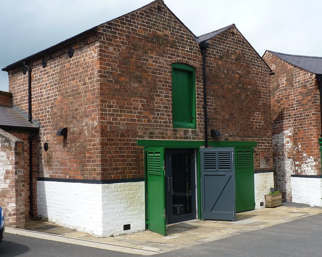
Image: © Richard Law Taken: 31 May 2018
These buildings, in the process of becoming part of the Visitor Centre for the extensive Flax Mill restoration project, are the former stables on site, and were Grade II listed https://www.britishlistedbuildings.co.uk/101254856-ditherington-flax-mill-stables-and-remains-of-packing-warehouse-shrewsbury#.WzCMT6dKhPY in 1987. The 'packing mill' referred to in the listing details is just offshot to the left, but was more or less completely demolished in the late 1970s.
Images are licensed for reuse under creativecommons.org/licenses/by-sa/2.0
Image Location
Latitude
52.719333
Longitude
-2.744336