High Street, Haverhill
Introduction
The photograph on this page of High Street, Haverhill by Robin Webster as part of the Geograph project.
The Geograph project started in 2005 with the aim of publishing, organising and preserving representative images for every square kilometre of Great Britain, Ireland and the Isle of Man.

There are currently over 7.5m images from over 14,400 individuals and you can help contribute to the project by visiting https://www.geograph.org.uk
High Street, Haverhill
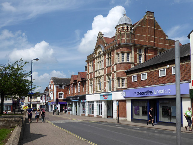
Image: © Robin Webster Taken: 3 Jun 2018
The northern end. This part has been called Market Hill, but the premises are numbered in the High Street sequence and there is no apparent name plate. Beyond Peacocks, the continuation is called Queen Street. The Argos building was formerly the Co-op, built 1896.
Images are licensed for reuse under creativecommons.org/licenses/by-sa/2.0
Image Location
Latitude
52.083063
Longitude
0.438298