Balmossie Viaduct
Introduction
The photograph on this page of Balmossie Viaduct by Russel Wills as part of the Geograph project.
The Geograph project started in 2005 with the aim of publishing, organising and preserving representative images for every square kilometre of Great Britain, Ireland and the Isle of Man.

There are currently over 7.5m images from over 14,400 individuals and you can help contribute to the project by visiting https://www.geograph.org.uk
Balmossie Viaduct
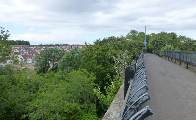
Image: © Russel Wills Taken: 18 Jun 2018
Showing the height above Dighty Water and the new housing north of the river. The railings are for the safety of pedestrians and not original!
Images are licensed for reuse under creativecommons.org/licenses/by-sa/2.0
Image Location
Latitude
56.482559
Longitude
-2.841844