
The Kempock Stone
Introduction
The photograph on this page of The Kempock Stone by Lairich Rig as part of the Geograph project.
The Geograph project started in 2005 with the aim of publishing, organising and preserving representative images for every square kilometre of Great Britain, Ireland and the Isle of Man.

There are currently over 7.5m images from over 14,400 individuals and you can help contribute to the project by visiting https://www.geograph.org.uk
The Kempock Stone
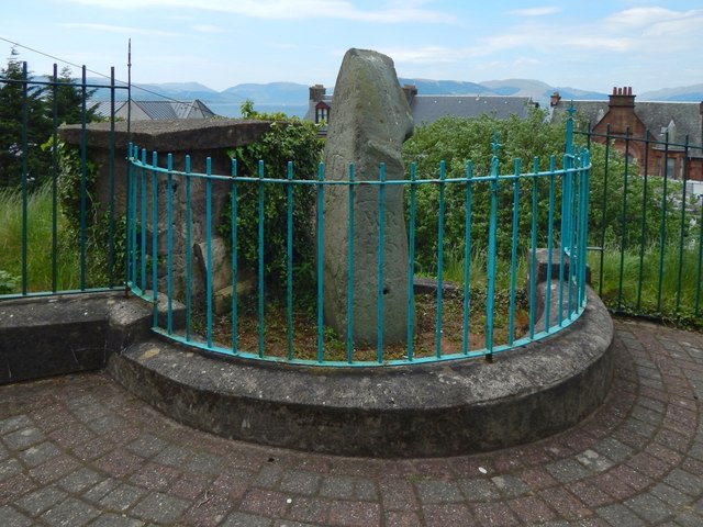
Image: © Lairich Rig Taken: 26 May 2018
A Image identifies it as a Bronze Age standing stone from about 2000 BC (in the absence of dated artefacts associated with the stone, that date should be understood as necessarily very approximate: plus or minus a few centuries). The local traditions reported by a nineteenth-century minister (as quoted on that plaque) about the stone's being erected by Druids can therefore be disregarded, as can the notion that it was used by them as an "altar to Baal" (even if, as seems likely, the minister was simply using the name "Baal" as a convenient shorthand for "whatever deity or deities the Druids worshipped"). [I have the impression that there was a popular tendency in the nineteenth century to give the Druids the credit for all sorts of conspicuous antiquities; see Image for one example on the other side of the Clyde. That this tendency lingered into the twentieth century is shown by the debate (beginning in the 1930s) over the so-called "Druid Temple" at Knappers, near Clydebank.] For closer views, on the same day, see Image and Image; the first of these shows the resemblance to a stooped, cowled figure that accounts for the popular name "Granny Kempock" (as those familiar with the area will know, the Kempock part of the name is from the nearby place-name Kempock Point). See Image for some of the other traditions and stories associated with the stone. Click on the end-note title for other pictures.
Images are licensed for reuse under creativecommons.org/licenses/by-sa/2.0
Image Location

Latitude
55.961343
Longitude
-4.819952