Parish boundary marker, Barrack Lane
Introduction
The photograph on this page of Parish boundary marker, Barrack Lane by Alan Murray-Rust as part of the Geograph project.
The Geograph project started in 2005 with the aim of publishing, organising and preserving representative images for every square kilometre of Great Britain, Ireland and the Isle of Man.

There are currently over 7.5m images from over 14,400 individuals and you can help contribute to the project by visiting https://www.geograph.org.uk
Parish boundary marker, Barrack Lane
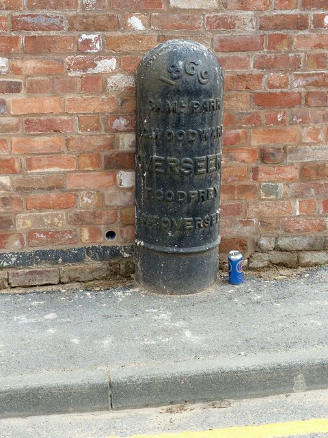
Image: © Alan Murray-Rust Taken: 12 Jun 2018
Classic Nottingham round headed cast iron boundary post, dated 1869. Listed Grade II. When I last passed this way in 2014, it was unphotographable under luxuriant buddleia, much as this view http://www.geograph.org.uk/photo/2993882 , but worse.
Images are licensed for reuse under creativecommons.org/licenses/by-sa/2.0
Image Location
Latitude
52.953923
Longitude
-1.167905