Borrowash Lower (or Shackleford) Lock
Introduction
The photograph on this page of Borrowash Lower (or Shackleford) Lock by Alan Murray-Rust as part of the Geograph project.
The Geograph project started in 2005 with the aim of publishing, organising and preserving representative images for every square kilometre of Great Britain, Ireland and the Isle of Man.

There are currently over 7.5m images from over 14,400 individuals and you can help contribute to the project by visiting https://www.geograph.org.uk
Borrowash Lower (or Shackleford) Lock
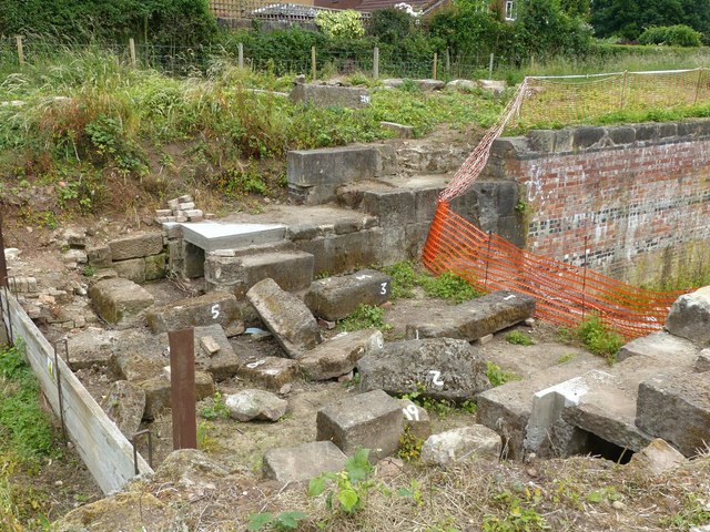
Image: © Alan Murray-Rust Taken: 12 Jun 2018
Currently undergoing restoration by the Derby and Sandiacre Canal Trust. The large stones were all recovered from the lock chamber which had been filled with rubble and have been measured and numbered so that the best placement for them can be worked out in advance.
Images are licensed for reuse under creativecommons.org/licenses/by-sa/2.0
Image Location
Latitude
52.90207
Longitude
-1.376145