Hatton community hall
Introduction
The photograph on this page of Hatton community hall by Bill Harrison as part of the Geograph project.
The Geograph project started in 2005 with the aim of publishing, organising and preserving representative images for every square kilometre of Great Britain, Ireland and the Isle of Man.

There are currently over 7.5m images from over 14,400 individuals and you can help contribute to the project by visiting https://www.geograph.org.uk
Hatton community hall
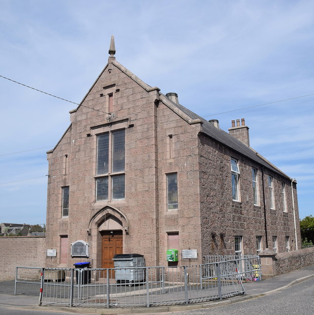
Image: © Bill Harrison Taken: 19 May 2018
Quite a lavish two-storey structure from 1905 for a small village with "Tudor-Jacobean gable front" as the Buildings of Scotland (Pevsner) Guide puts it. Note the war memorial plaque to the left of the doors, which formerly adorned Cruden West kirk (see: https://www.geograph.org.uk/photo/237552 ) a few hundred metres to the west, until it burned down in 2015.
Images are licensed for reuse under creativecommons.org/licenses/by-sa/2.0
Image Location
Latitude
57.424498
Longitude
-1.915397