Path beside former site of Arkleston House
Introduction
The photograph on this page of Path beside former site of Arkleston House by Lairich Rig as part of the Geograph project.
The Geograph project started in 2005 with the aim of publishing, organising and preserving representative images for every square kilometre of Great Britain, Ireland and the Isle of Man.

There are currently over 7.5m images from over 14,400 individuals and you can help contribute to the project by visiting https://www.geograph.org.uk
Path beside former site of Arkleston House
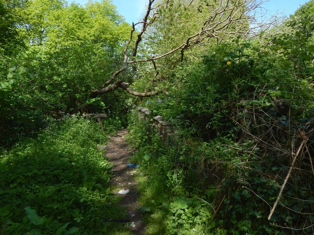
Image: © Lairich Rig Taken: 19 May 2018
Arkleston House, now gone, was once known as West Arkleston. At the time of writing, North and South Arkleston survive as working farms, and East Arkleston as ruins: Image / Image / Image See Image for more on this area as a whole. Note the section of wall just to the right (east) of the path in the present picture. Image is just to the east, but the section of wall shown in the present picture is not part of the side-wall of the house itself. For one thing, this section of low wall has its top intact; it is clearly not a fragment of anything taller. But, more tellingly, it runs SSE—NNW (while the western wall of the house ran SSW—NNE). This wall has the appearance of the boundary of a garden, and that is probably what it was: the 1939 revision of the OS map shows a track heading in this direction, just west of the former site of the house, and this wall probably served to separate that track from the garden of the house. The line of the track itself survives as the woodland path shown in the present picture (and in Image / Image). Other low traces, no more than footings, survive nearby, crossing the line of the path in the area just behind the photographer.
Images are licensed for reuse under creativecommons.org/licenses/by-sa/2.0
Image Location
Latitude
55.857177
Longitude
-4.399935