Lea Bridge Road, Leyton
Introduction
The photograph on this page of Lea Bridge Road, Leyton by Malc McDonald as part of the Geograph project.
The Geograph project started in 2005 with the aim of publishing, organising and preserving representative images for every square kilometre of Great Britain, Ireland and the Isle of Man.

There are currently over 7.5m images from over 14,400 individuals and you can help contribute to the project by visiting https://www.geograph.org.uk
Lea Bridge Road, Leyton
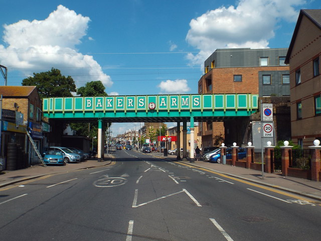
Image: © Malc McDonald Taken: 3 Jun 2018
Lea Bridge Road in Leyton, in the suburbs of north east London. This image was taken on a Sunday afternoon, when traffic levels were light. The bridge carries the Gospel Oak to Barking railway line across the road. "Bakers Arms" refers to a road junction a short distance further along the road. It was doubtlessly named after a pub which stood there.
Images are licensed for reuse under creativecommons.org/licenses/by-sa/2.0
Image Location
Latitude
51.573622
Longitude
-0.01524