Boddam parish kirk
Introduction
The photograph on this page of Boddam parish kirk by Bill Harrison as part of the Geograph project.
The Geograph project started in 2005 with the aim of publishing, organising and preserving representative images for every square kilometre of Great Britain, Ireland and the Isle of Man.

There are currently over 7.5m images from over 14,400 individuals and you can help contribute to the project by visiting https://www.geograph.org.uk
Boddam parish kirk
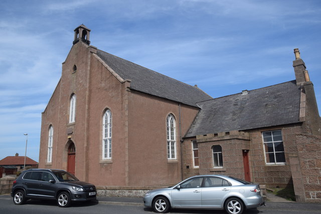
Image: © Bill Harrison Taken: 19 May 2018
Dated 1865 with minimalist bellcote but more like Aberdeenshire 'Georgian Gothic' kirks from 60 years earlier such as Echt kirk (http://www.geograph.org.uk/photo/4758650 ) or Kirkton of Skene kirk (http://www.geograph.org.uk/photo/5239085 ). C-listed (LB16314): http://portal.historicenvironment.scot/designation/LB16314 . Update (August 2020): the church is now converted to residential use.
Images are licensed for reuse under creativecommons.org/licenses/by-sa/2.0
Image Location
Latitude
57.471316
Longitude
-1.781244