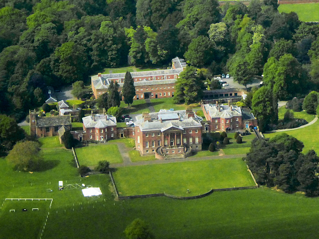
Cheshire, Tabley House and St Peter's Chapel (aerial)
Introduction
The photograph on this page of Cheshire, Tabley House and St Peter's Chapel (aerial) by David Dixon as part of the Geograph project.
The Geograph project started in 2005 with the aim of publishing, organising and preserving representative images for every square kilometre of Great Britain, Ireland and the Isle of Man.
There are currently over 7.5m images from over 14,400 individuals and you can help contribute to the project by visiting https://www.geograph.org.uk

Image: © David Dixon Taken: 16 May 2018
The large, Palladian-style building at the front is Tabley House, a former stately home approximately 2 miles to the east of Knutsford. Built between 1761 and 1769, the house is recorded in the National Heritage List for England as a designated Grade I listed building (Historic England List entry Number: 1115424 https://historicengland.org.uk/listing/the-list/list-entry/1115424 ). To the west of the house is St Peter's Church, also listed Grade I (Historic England List entry Number: 1329685 https://historicengland.org.uk/listing/the-list/list-entry/1329685 ), which was moved from a position adjacent to Tabley Old Hall to its present site in 1927. There are other listed buildings in the grounds including the large stable block to the rear which is Grade II-listed (Historic England List entry Number: 1139486 https://historicengland.org.uk/listing/the-list/list-entry/1139486 ).

