France seen from the top of Summerhouse Hill
Introduction
The photograph on this page of France seen from the top of Summerhouse Hill by Marathon as part of the Geograph project.
The Geograph project started in 2005 with the aim of publishing, organising and preserving representative images for every square kilometre of Great Britain, Ireland and the Isle of Man.

There are currently over 7.5m images from over 14,400 individuals and you can help contribute to the project by visiting https://www.geograph.org.uk
France seen from the top of Summerhouse Hill
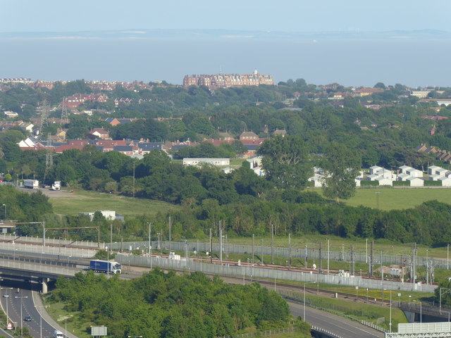
Image: © Marathon Taken: 27 May 2018
Travelling along the M20 towards Folkestone and Dover, Summerhouse Hill is the distinctive conical hill seen on the left, just before the Channel Tunnel terminal is reached. Its chalk slopes are quite steep but there are fine views from the top and because of its position it is possible on a clear day to see the French coast well beyond Boulogne to the south. See https://www.geograph.org.uk/photo/2167121 for more information about Summerhouse Hill. This view looks beyond The Leas at Folkestone to the coast of France. The distinctive buildings in the centre on this side of the English Channel are the Metropole and Grand Hotels on The Leas - see https://www.geograph.org.uk/photo/5794815 A few hours before this photograph was taken it was so misty that it was possible to only see about a quarter mile out to sea - see https://www.geograph.org.uk/photo/5795774
Images are licensed for reuse under creativecommons.org/licenses/by-sa/2.0
Image Location
Latitude
51.0752
Longitude
1.162332