WWII Lancashire: Leeds & Liverpool Canal: Slipway public house, Burscough (23)
Introduction
The photograph on this page of WWII Lancashire: Leeds & Liverpool Canal: Slipway public house, Burscough (23) by Mike Searle as part of the Geograph project.
The Geograph project started in 2005 with the aim of publishing, organising and preserving representative images for every square kilometre of Great Britain, Ireland and the Isle of Man.

There are currently over 7.5m images from over 14,400 individuals and you can help contribute to the project by visiting https://www.geograph.org.uk
WWII Lancashire: Leeds & Liverpool Canal: Slipway public house, Burscough (23)
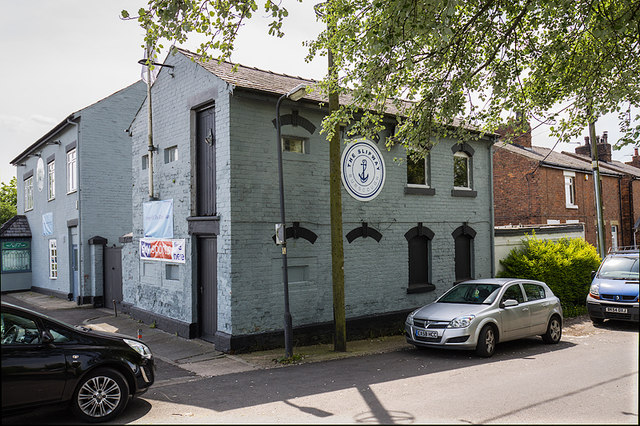
Image: © Mike Searle Taken: 18 May 2018
- Defended Building: DoB ID: S0011731 This former two-storey stable block attached to the Slipway public house once stabled horses for towing canal barges. Overlooking the canal and Crabtree Bridge, it was converted into a strongpoint in 1940 by the insertion of embrasures on both levels. The NW side seen here facing along the canal has two embrasures, the one on the upper level having been glazed, whilst the lower is blocked. The NE side facing the canal has two loopholes on the upper level (glazed), and two at the lower (blocked). There is also a single (glazed) embrasure visible at the upper level on the SE side facing along the canal. Image
Images are licensed for reuse under creativecommons.org/licenses/by-sa/2.0
Image Location
Latitude
53.604347
Longitude
-2.859858