Stratford-upon-Avon: almshouses, Chapel Street
Introduction
The photograph on this page of Stratford-upon-Avon: almshouses, Chapel Street by John Sutton as part of the Geograph project.
The Geograph project started in 2005 with the aim of publishing, organising and preserving representative images for every square kilometre of Great Britain, Ireland and the Isle of Man.

There are currently over 7.5m images from over 14,400 individuals and you can help contribute to the project by visiting https://www.geograph.org.uk
Stratford-upon-Avon: almshouses, Chapel Street
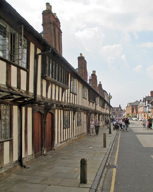
Image: © John Sutton Taken: 21 Apr 2018
Built by the Guild of the Holy Cross in 1427-8. The Grade I listing explains why these almshouses are historically significant: "The group, which dates from the early C15, forms a large and uniform composition. The use of so much timber in the close-studded walling, a bracketed jetty and the oriel windows all mark this as a prestigious project with accomplished carpentry".
Images are licensed for reuse under creativecommons.org/licenses/by-sa/2.0
Image Location
Latitude
52.190092
Longitude
-1.708562