The White House (Tupsley)
Introduction
The photograph on this page of The White House (Tupsley) by Fabian Musto as part of the Geograph project.
The Geograph project started in 2005 with the aim of publishing, organising and preserving representative images for every square kilometre of Great Britain, Ireland and the Isle of Man.

There are currently over 7.5m images from over 14,400 individuals and you can help contribute to the project by visiting https://www.geograph.org.uk
The White House (Tupsley)
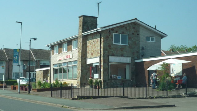
Image: © Fabian Musto Taken: 23 May 2018
Not to be confused with the famous White House at America. The White House Community Hub used to be a pub in its former days, opening around the mid 1960s I believe. It closed around the 2010s and shortly afterwards it was converted into another use.
Images are licensed for reuse under creativecommons.org/licenses/by-sa/2.0
Image Location
Latitude
52.061582
Longitude
-2.688715