Former Black Isle Railway Underbridge
Introduction
The photograph on this page of Former Black Isle Railway Underbridge by valenta as part of the Geograph project.
The Geograph project started in 2005 with the aim of publishing, organising and preserving representative images for every square kilometre of Great Britain, Ireland and the Isle of Man.

There are currently over 7.5m images from over 14,400 individuals and you can help contribute to the project by visiting https://www.geograph.org.uk
Former Black Isle Railway Underbridge
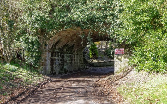
Image: © valenta Taken: 12 Apr 2018
Bishops Road passes under the long-closed Muir of Ord to Fortrose Railway line, the bridge now totally covered in Ivy. After passing under the bridge, one can either turn sharp right and continue onto the trackbed of the old railway line where a very pleasant walk or cycle to Avoch can be had, or follow a path up the hill to join the Killen Road
Images are licensed for reuse under creativecommons.org/licenses/by-sa/2.0
Image Location
Latitude
57.580352
Longitude
-4.136953