Large sign and small sign, Harbour Road, Seaton
Introduction
The photograph on this page of Large sign and small sign, Harbour Road, Seaton by Jaggery as part of the Geograph project.
The Geograph project started in 2005 with the aim of publishing, organising and preserving representative images for every square kilometre of Great Britain, Ireland and the Isle of Man.

There are currently over 7.5m images from over 14,400 individuals and you can help contribute to the project by visiting https://www.geograph.org.uk
Large sign and small sign, Harbour Road, Seaton
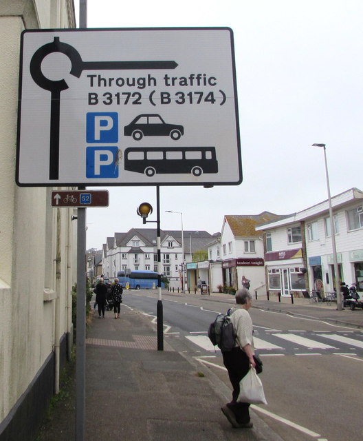
Image: © Jaggery Taken: 20 May 2018
Facing westbound traffic on the B3172 Harbour Road on the approach to a roundabout. The larger sign shows the road for through traffic and a car park & coach/bus park. The much smaller sign shows the number 52 next to a depiction of a bicycle, which indicates National Cycle Network Route 52. This appears to be an error because route 52 is in the English Midlands whereas Seaton in East Devon is on the south coast of England. It looks like this is Route 2, a long distance cycle route which, when complete, will link Dover in Kent with St Austell in Cornwall via the south coast of England.
Images are licensed for reuse under creativecommons.org/licenses/by-sa/2.0
Image Location
Latitude
50.704301
Longitude
-3.066846