Disused railway, Sheerness
Introduction
The photograph on this page of Disused railway, Sheerness by Robin Webster as part of the Geograph project.
The Geograph project started in 2005 with the aim of publishing, organising and preserving representative images for every square kilometre of Great Britain, Ireland and the Isle of Man.

There are currently over 7.5m images from over 14,400 individuals and you can help contribute to the project by visiting https://www.geograph.org.uk
Disused railway, Sheerness
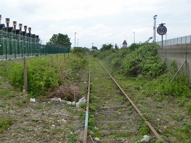
Image: © Robin Webster Taken: 16 May 2018
A freight line that gave one access to the Sheerness Steel site and also to the dockyard. The steelworks site is being redeveloped and the trackwork has gone, but the link beyond remains through to the dockyard, crossing the A259 on the level. This is looking towards the junction with the main Sheerness branch.
Images are licensed for reuse under creativecommons.org/licenses/by-sa/2.0
Image Location
Latitude
51.436256
Longitude
0.748602