Information board
Introduction
The photograph on this page of Information board by Michael Dibb as part of the Geograph project.
The Geograph project started in 2005 with the aim of publishing, organising and preserving representative images for every square kilometre of Great Britain, Ireland and the Isle of Man.

There are currently over 7.5m images from over 14,400 individuals and you can help contribute to the project by visiting https://www.geograph.org.uk
Information board
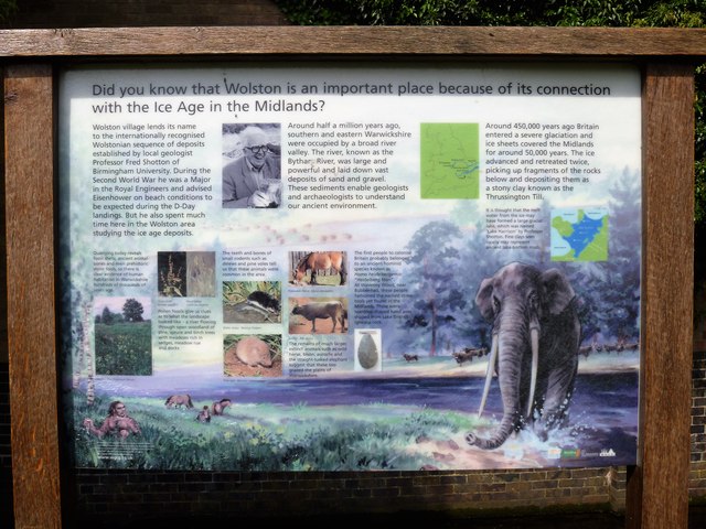
Image: © Michael Dibb Taken: 13 May 2018
The board details the Ice Age in the Midlands and how the village lends its name to the Wolstonian sequence of deposits.
Images are licensed for reuse under creativecommons.org/licenses/by-sa/2.0
Image Location
Latitude
52.375812
Longitude
-1.395042