
Battery Park
Introduction
The photograph on this page of Battery Park by Thomas Nugent as part of the Geograph project.
The Geograph project started in 2005 with the aim of publishing, organising and preserving representative images for every square kilometre of Great Britain, Ireland and the Isle of Man.

There are currently over 7.5m images from over 14,400 individuals and you can help contribute to the project by visiting https://www.geograph.org.uk
Battery Park
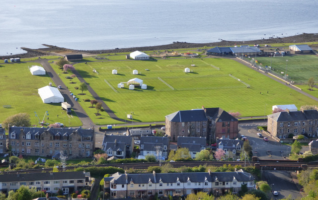
Image: © Thomas Nugent Taken: 12 May 2018
The marquees and barriers are in preparation for the Gourock Highland Games (the first games of the season in Scotland) which will be held the following day. The slipway at the top left was used by flying boats during WWII, when the park was home to RAF Greenock. It was a flying boat maintenance unit, transferred away from Calshot to a more "safe" area in 1940. Much of the work performed there was equipping standard flying boats with essential RAF equipment.
Images are licensed for reuse under creativecommons.org/licenses/by-sa/2.0
Image Location

Latitude
55.958261
Longitude
-4.797455