Bangor Grammar School
Introduction
The photograph on this page of Bangor Grammar School by Rossographer as part of the Geograph project.
The Geograph project started in 2005 with the aim of publishing, organising and preserving representative images for every square kilometre of Great Britain, Ireland and the Isle of Man.

There are currently over 7.5m images from over 14,400 individuals and you can help contribute to the project by visiting https://www.geograph.org.uk
Bangor Grammar School
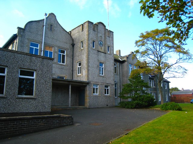
Image: © Rossographer Taken: 6 Oct 2007
This is the oldest section of the school, dating from 1905. The rest of the school buildings (unseen, behind) have been built in stages over the last 100 years. This building is known as the Crosby Building - in fact, only the far right hand portion, added in 1914, is officially known as Crosby House. The low section on the left was added in 1960. This was taken in 2007 when the school was still sited here: the site was vacated at the end of 2012 when it relocated to a new campus on Gransha Road. The Crosby Building/Crosby House is retained, the other buildings demolished (see http://www.geograph.org.uk/snippet/8816 ).
Images are licensed for reuse under creativecommons.org/licenses/by-sa/2.0
Image Location
Latitude
54.664913
Longitude
-5.660022