
Priory View river frontage
Introduction
The photograph on this page of Priory View river frontage by Evelyn Simak as part of the Geograph project.
The Geograph project started in 2005 with the aim of publishing, organising and preserving representative images for every square kilometre of Great Britain, Ireland and the Isle of Man.

There are currently over 7.5m images from over 14,400 individuals and you can help contribute to the project by visiting https://www.geograph.org.uk
Priory View river frontage
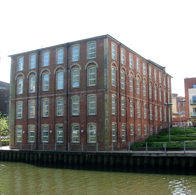
Image: © Evelyn Simak Taken: 6 May 2018
Seen here is one of the old industrial buildings on the Carrow Works site which has since been converted into flats and called Priory View. The Grade 2 listed building used to be the Carrow Works block 60, constructed in 1870-1880 from Somerleyton bricks with red dressings and a hipped slate roof. From 1926 - 1940 it was the barley and groats mill but by 1960 it was used for Colman's dry sauces. In 1991 Colman's dry sauces mix was produced here. For a view of this building taken from King Street see > http://www.geograph.org.uk/photo/5766226. Jeremiah Colman had started his mustard and flour business in 1814 at Stoke Holy Cross. It was, however, his great-nephew Jeremiah James Colman who in 1850 bought land from Norfolk Railway at Carrow, and in 1858 brought the company to Carrow and established the Carrow Works which by 1869 had 1100 employees. Colman’s won a special place in the heart of workers in the city, because the company looked after its employees, who enjoyed better conditions than in many other city factories. Many of the old Carrow Works buildings have since been converted into housing. See also > https://www.geograph.org.uk/photo/5766204.
Images are licensed for reuse under creativecommons.org/licenses/by-sa/2.0
Image Location

Latitude
52.620371
Longitude
1.308082