Mary Hatch almshouses, Wicken
Introduction
The photograph on this page of Mary Hatch almshouses, Wicken by Keith Edkins as part of the Geograph project.
The Geograph project started in 2005 with the aim of publishing, organising and preserving representative images for every square kilometre of Great Britain, Ireland and the Isle of Man.

There are currently over 7.5m images from over 14,400 individuals and you can help contribute to the project by visiting https://www.geograph.org.uk
Mary Hatch almshouses, Wicken
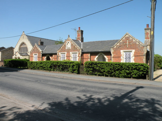
Image: © Keith Edkins Taken: 7 May 2018
Erected 1852. Red brick with yellow gault brick dressings and slate roof of fish scale pattern slates. Grade II listed.
Images are licensed for reuse under creativecommons.org/licenses/by-sa/2.0
Image Location
Latitude
52.31296
Longitude
0.296717