
Hall Farm, Packington
Introduction
The photograph on this page of Hall Farm, Packington by Oliver Mills as part of the Geograph project.
The Geograph project started in 2005 with the aim of publishing, organising and preserving representative images for every square kilometre of Great Britain, Ireland and the Isle of Man.

There are currently over 7.5m images from over 14,400 individuals and you can help contribute to the project by visiting https://www.geograph.org.uk
Hall Farm, Packington
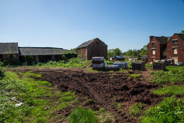
Image: © Oliver Mills Taken: 6 May 2018
Progress is finally being made towards redeveloping the site for housing. The farmhouse and one other farm building will be retained, whilst the others will be completely replaced, due to their very poor structural condition. The buildings on the left will be demolished; the southern (rear) side of the two-storey building and the adjoining building has completely collapsed. A single-storey building between these buildings and the farmhouse (right) had also partially collapsed and has already been demolished. It can be seen here Image The current planning application was submitted in November 2015, with some preliminary surveys conducted the year before.
Images are licensed for reuse under creativecommons.org/licenses/by-sa/2.0
Image Location

Latitude
52.728658
Longitude
-1.467766