
Roofscape of the City of London
Introduction
The photograph on this page of Roofscape of the City of London by Rudi Winter as part of the Geograph project.
The Geograph project started in 2005 with the aim of publishing, organising and preserving representative images for every square kilometre of Great Britain, Ireland and the Isle of Man.

There are currently over 7.5m images from over 14,400 individuals and you can help contribute to the project by visiting https://www.geograph.org.uk
Roofscape of the City of London
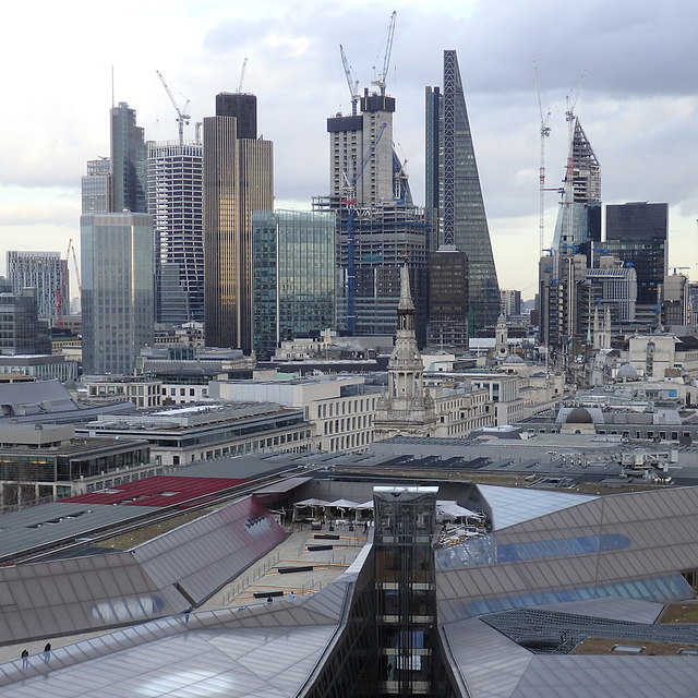
Image: © Rudi Winter Taken: 12 Feb 2018
What looks like ground level is in fact the roof height of most buildings in the City of London. The uniform height is due to local byelaws originally related to the height fire engines could reach before sprinklers and wet risers became the norm in large buildings. Exceptions tend to be either very new, such as the skyscraper precinct of the City in the background or very old such as the spire of St Mary-le-Bow at the centre. A new high-rise building is currently being built up around its core segment, which is already in place. In the foreground can be seen the lift shaft of a shopping centre to give some sense of vertical scale. Taken from the viewing gallery on St Paul's cathedral dome http://www.geograph.org.uk/photo/5764063 .
Images are licensed for reuse under creativecommons.org/licenses/by-sa/2.0
Image Location

Latitude
51.513596
Longitude
-0.093803