Tomnahurich swing bridge, Inverness
Introduction
The photograph on this page of Tomnahurich swing bridge, Inverness by Richard Sutcliffe as part of the Geograph project.
The Geograph project started in 2005 with the aim of publishing, organising and preserving representative images for every square kilometre of Great Britain, Ireland and the Isle of Man.

There are currently over 7.5m images from over 14,400 individuals and you can help contribute to the project by visiting https://www.geograph.org.uk
Tomnahurich swing bridge, Inverness
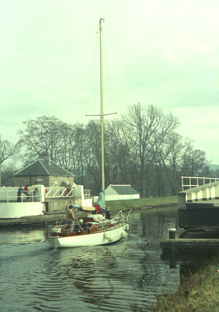
Image: © Richard Sutcliffe Taken: Unknown
The bridge is open to allow a boat to pass along the Caledonian Canal. The bridge keeper's cottage beyond the bridge probably dates from about 1820 and is Category C listed [http://portal.historicenvironment.scot/designation/LB52230].
Images are licensed for reuse under creativecommons.org/licenses/by-sa/2.0
Image Location
Latitude
57.464442
Longitude
-4.245568