Carman Industrial Estate
Introduction
The photograph on this page of Carman Industrial Estate by Lairich Rig as part of the Geograph project.
The Geograph project started in 2005 with the aim of publishing, organising and preserving representative images for every square kilometre of Great Britain, Ireland and the Isle of Man.

There are currently over 7.5m images from over 14,400 individuals and you can help contribute to the project by visiting https://www.geograph.org.uk
Carman Industrial Estate
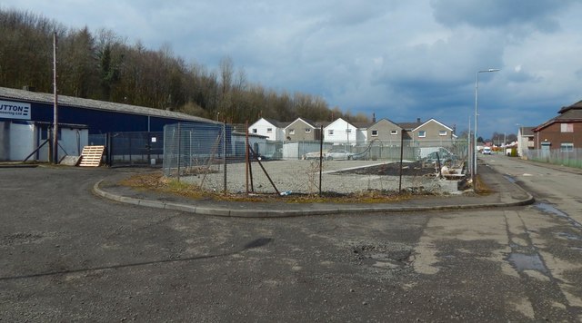
Image: © Lairich Rig Taken: 14 Apr 2018
The ground at the centre of the image had recently been waste ground (Image), but was now being laid out for storage; specifically, to support large metal storage containers that were set up here later: Image The fence was replaced soon after the present picture was taken: Image The houses in the central background are on Station Street. Back Street is on the right. Part of this area is seen, as rough ground, at the far right in an earlier picture: Image
Images are licensed for reuse under creativecommons.org/licenses/by-sa/2.0
Image Location
Latitude
55.969632
Longitude
-4.585592